
Can Towin Provide Custom Medical Lenses?
06/17/2026
What Lens Is Best for Aerial Mapping Drones?
06/18/2026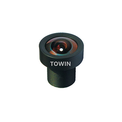
UAV cameras play a critical role in aerial mapping, industrial inspection, surveillance, agriculture, and autonomous navigation. While camera resolution and sensor size often receive the most attention, the field of view (FOV) is equally important for determining how much of a scene can be captured and how much detail can be retained.
Choosing the wrong field of view can reduce image quality, decrease operational efficiency, and negatively impact mission performance. A lens with an excessively wide angle may introduce distortion and reduce target detail, while a narrow field of view may limit coverage and require additional flight time.
Whether you are designing a commercial drone, an industrial UAV platform, or an AI-powered aerial vision system, selecting the correct field of view is essential. For an overview of drone optical applications, explore our Drone Imaging Lens Solutions.
What Is Field of View (FOV)?
Field of view (FOV) refers to the observable area that a camera lens can capture at a given distance. In UAV imaging systems, FOV is primarily determined by three factors:
- Sensor size
- Lens focal length
- Working distance or flight altitude
A larger sensor or shorter focal length generally produces a wider field of view. Understanding the relationship between sensor size and focal length is critical when selecting a drone lens. Learn more in our Sensor Size Guide and use our FOV Calculator to estimate coverage area.
Why Is Field of View Important for UAV Cameras?
Coverage Area
A wider field of view allows drones to capture larger areas in a single image, improving efficiency in mapping and surveying applications.
Image Detail
A narrower field of view concentrates pixels on a smaller area, providing greater image detail and better target recognition.
Flight Efficiency
Optimized FOV reduces the number of flight paths required to cover a site, lowering operational costs.
Object Recognition Accuracy
Inspection drones often require narrower viewing angles to identify defects, cracks, or component failures.
AI Vision Performance
Artificial intelligence systems rely on image quality and object visibility. Proper lens selection improves detection accuracy for machine vision algorithms. Learn more about AI imaging applications in our Machine Vision Solutions.
Typical FOV Ranges for UAV Cameras
| Field of View | Lens Type | Typical Application |
|---|---|---|
| 120°–180° | Fisheye Lens | FPV Drones |
| 90°–120° | Ultra Wide-Angle Lens | Obstacle Avoidance |
| 60°–90° | Wide-Angle Lens | General UAV Imaging |
| 30°–60° | Standard Lens | Industrial Inspection |
| Below 30° | Telephoto Lens | Long-Range Surveillance |
The ideal field of view depends on the mission requirements rather than simply choosing the widest possible lens.
Recommended FOV for Different UAV Applications
Aerial Mapping and Surveying
Recommended FOV: 60°–90°
Mapping applications require a balance between coverage area and image accuracy. Extremely wide lenses may introduce distortion that affects measurement precision.
Explore related solutions in our Drone Imaging Lens Solutions.
Agricultural Drones
Recommended FOV: 70°–100°
Agricultural monitoring often benefits from wider coverage to efficiently inspect crops and farmland.
Industrial Inspection
Recommended FOV: 30°–60°
Power line inspection, infrastructure assessment, and equipment monitoring require greater image detail and improved target visibility.
Security and Surveillance Drones
Recommended FOV: 20°–50°
Security drones prioritize identification and tracking over wide-area coverage. Learn more in our Smart Security Lens Solutions.
FPV Racing Drones
Recommended FOV: 120°–170°
FPV systems benefit from ultra-wide viewing angles that improve pilot awareness and navigation speed.
Autonomous Navigation Drones
Recommended FOV: 90°–140°
Obstacle avoidance and SLAM-based navigation systems require broad environmental awareness. See our Robotics Vision Solutions for related applications.
FOV vs. Focal Length: Understanding the Relationship
The focal length of a lens directly affects the field of view. Short focal lengths provide wider viewing angles, while longer focal lengths create narrower fields of view.
| Focal Length | Approximate FOV |
|---|---|
| 1.8mm | 160° |
| 2.1mm | 140° |
| 2.8mm | 120° |
| 4mm | 90° |
| 6mm | 70° |
| 8mm | 55° |
| 12mm | 35° |
For a deeper understanding of focal length selection, read our Lens Selection Guide.
How to Choose the Right Lens for UAV Cameras
Step 1: Determine Sensor Size
Sensor dimensions significantly influence the resulting field of view. Refer to our Sensor Guide.
Step 2: Define Flight Altitude
Higher flight altitudes generally require different viewing angles than low-altitude inspection missions.
Step 3: Calculate Coverage Requirements
Estimate the area that must be captured in each image and calculate the required FOV using our FOV Calculator.
Step 4: Select the Appropriate Focal Length
Match focal length to your target coverage and image detail requirements.
Step 5: Evaluate Distortion Performance
For mapping and measurement applications, low distortion is often essential. Learn more in our Optical Distortion Guide.
Recommended Lens Types for UAV Cameras
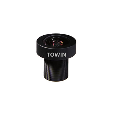
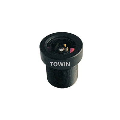
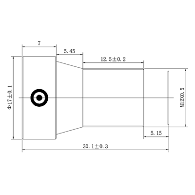
M12 Drone Lenses
Compact, lightweight, and ideal for embedded UAV platforms. Explore our M12 Lens Solutions.
Low Distortion Lenses
Optimized for mapping and surveying applications where measurement accuracy is critical.
Wide-Angle Lenses
Suitable for obstacle avoidance, navigation, and situational awareness.
Thermal Imaging Lenses
Designed for thermal drones used in inspection, agriculture, and public safety operations.
Frequently Asked Questions
Q: What is the best field of view for drone mapping?
A: Most mapping applications benefit from a field of view between 60° and 90°.
Q: Is a wider FOV always better?
A: No. Wider lenses increase coverage but may reduce image detail and introduce distortion.
Q: What FOV is commonly used in FPV drones?
A: Most FPV systems use lenses with a field of view between 120° and 170°.
Q: How does focal length affect UAV imaging?
A: Shorter focal lengths provide wider viewing angles, while longer focal lengths improve target magnification.
Q: What is the ideal FOV for agricultural drones?
A: Most agricultural applications use viewing angles between 70° and 100°.
Q: How can I calculate the required drone camera FOV?
A: Use our online FOV Calculator to estimate coverage area based on sensor size and focal length.
Q: Are M12 lenses suitable for UAV systems?
A: Yes. M12 lenses are widely used in lightweight drone cameras because of their compact size and low weight.
Q: Why are low-distortion lenses important for aerial mapping?
A: They improve measurement accuracy and reduce image correction requirements during post-processing.
Conclusion
The ideal field of view depends on the application, sensor size, flight altitude, and image detail requirements. Wide-angle lenses maximize coverage, while narrower viewing angles provide superior recognition and inspection performance.
Selecting the correct optical solution is one of the most important design decisions for professional UAV cameras. Whether your application involves aerial mapping, industrial inspection, agriculture, surveillance, or autonomous navigation, the right lens can significantly improve imaging performance and operational efficiency.
To learn more about optimized optical designs for UAV cameras, visit our Drone Imaging Lens Solutions.