
What Field of View Is Suitable for UAV Cameras?
06/18/2026
What Lens Mount Is Commonly Used in Medical Imaging Devices?
06/18/2026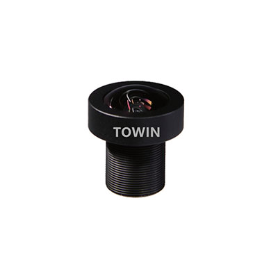
Aerial mapping drones are widely used for land surveying, construction planning, agriculture, mining, infrastructure inspection, and GIS data collection. While drone cameras continue to improve in resolution, the lens remains one of the most important factors affecting mapping accuracy and image quality.
Choosing the wrong lens can lead to distortion, inaccurate measurements, reduced ground sampling distance (GSD), and inefficient flight operations. The best aerial mapping lens should provide an optimal balance between field of view, image sharpness, distortion control, and sensor compatibility.
In this guide, we explain how to select the best lens for aerial mapping drones and what optical specifications should be considered before deployment. For a broader overview of UAV optical systems, visit our Drone Imaging Lens Solutions.
Why Lens Selection Matters in Aerial Mapping
Unlike general photography, aerial mapping requires highly accurate image data that can be processed into orthomosaics, 3D models, and geographic information systems (GIS).
A mapping lens directly affects:
- Ground coverage area
- Ground sampling distance (GSD)
- Image sharpness
- Distortion levels
- Measurement accuracy
- Photogrammetry performance
Even a high-resolution camera sensor cannot compensate for poor lens quality.
Key Characteristics of the Best Aerial Mapping Lens
Low Distortion Performance
Distortion is one of the most critical factors in mapping applications. Barrel distortion can introduce positional errors and increase post-processing workload.
For professional mapping projects, low-distortion lenses are strongly recommended. Learn more in our Optical Distortion Guide.
High Edge-to-Edge Sharpness
Mapping software uses image overlap to generate accurate models. Sharp image quality across the entire frame improves stitching accuracy and feature recognition.
Stable Optical Geometry
The lens should maintain consistent optical performance across temperature changes and vibration conditions commonly experienced during UAV flights.
Appropriate Field of View
The ideal field of view balances coverage area and image detail. Extremely wide-angle lenses may increase distortion, while narrow lenses reduce mapping efficiency.
For a detailed explanation, read our guide on What Field of View Is Suitable for UAV Cameras?.
What Focal Length Is Best for Aerial Mapping Drones?
There is no universal focal length for every mapping mission. The optimal choice depends on flight altitude, sensor size, and mapping accuracy requirements.
| Focal Length | Typical FOV | Recommended Use |
|---|---|---|
| 2.8mm | Ultra Wide | Large Area Coverage |
| 4mm | Wide | General Mapping |
| 6mm | Medium | High Accuracy Mapping |
| 8mm | Narrow | Detailed Surveying |
| 12mm+ | Telephoto | Long-Range Inspection |
For most commercial mapping drones, lenses between 4mm and 8mm provide the best balance between coverage and measurement accuracy.
Sensor Size and Lens Compatibility
The same focal length produces different fields of view depending on sensor size.
For example:
- 1/3″ Sensor + 4mm Lens
- 1/2.8″ Sensor + 4mm Lens
- 1/1.8″ Sensor + 4mm Lens
Each combination creates a different viewing angle and coverage area.
Before selecting a mapping lens, consult our Sensor Size Guide.
Recommended Lens Types for Aerial Mapping Drones
Low-Distortion Mapping Lenses
These lenses are specifically designed to minimize geometric errors and improve photogrammetry accuracy.
Best for:
- Land surveying
- GIS mapping
- Construction projects
- Mining operations
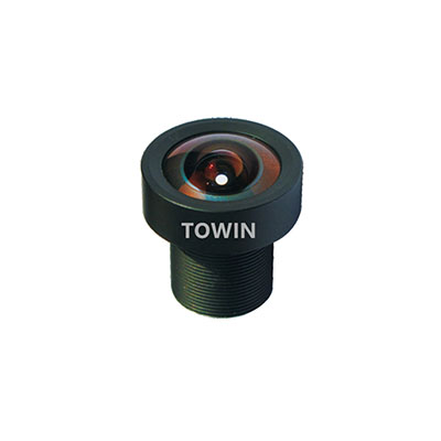
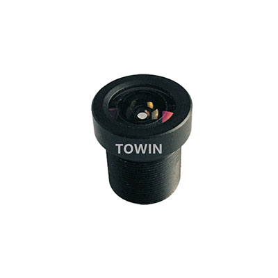
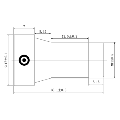
M12 Mapping Lenses
Compact and lightweight M12 lenses are often used in UAV systems where payload weight is critical.
Explore our M12 Lens Solutions.
High-Resolution Lenses
As drone cameras move toward 8MP, 12MP, and higher resolutions, lens resolving power becomes increasingly important.
Wide-Angle UAV Lenses
Suitable for applications requiring maximum area coverage with fewer flight passes.
How to Choose the Right Mapping Lens
Step 1: Define Mapping Objectives
Determine whether the mission focuses on land surveying, agriculture, infrastructure inspection, or 3D reconstruction.
Step 2: Select Sensor Size
Sensor dimensions influence field of view and image quality. Review our Sensor Guide.
Step 3: Calculate Required Coverage Area
Estimate the area captured per image using our FOV Calculator.
Step 4: Evaluate Distortion Requirements
Mapping projects require low distortion to ensure accurate measurements and reduce software correction.
Step 5: Verify Resolution Compatibility
The lens should support the sensor resolution to maintain image clarity across the entire frame.
Aerial Mapping vs Inspection Lenses
| Feature | Mapping Lens | Inspection Lens |
|---|---|---|
| Field of View | Medium-Wide | Narrow |
| Distortion | Very Low | Moderate |
| Coverage Area | Large | Small |
| Target Detail | Balanced | Maximum |
For inspection-focused UAV systems, explore our Drone Imaging Solutions.
Frequently Asked Questions
Q: What focal length is best for drone mapping?
A: Most aerial mapping drones use focal lengths between 4mm and 8mm.
Q: Why is low distortion important in aerial mapping?
A: Low distortion improves measurement accuracy and reduces image correction during photogrammetry processing.
Q: Can M12 lenses be used for mapping drones?
A: Yes. Many lightweight UAV platforms use M12 lenses when payload weight is a priority.
Q: What field of view is best for mapping drones?
A: Most mapping applications perform best with a field of view between 60° and 90°.
Q: Do higher megapixel cameras require better lenses?
A: Yes. Higher-resolution sensors require lenses with greater resolving power.
Q: How can I calculate drone mapping coverage?
A: Use our FOV Calculator to estimate coverage based on sensor size and focal length.
Q: What lens is best for agricultural mapping drones?
A: Wide-angle low-distortion lenses are commonly used for agricultural monitoring and crop analysis.
Q: What is the difference between mapping lenses and FPV lenses?
A: Mapping lenses prioritize accuracy and low distortion, while FPV lenses prioritize wide viewing angles and pilot awareness.
Conclusion
The best lens for aerial mapping drones combines low distortion, high image sharpness, appropriate focal length, and compatibility with the camera sensor. For most professional mapping applications, lenses in the 4mm–8mm range provide the optimal balance between coverage area and measurement accuracy.
Selecting the right optical solution can significantly improve mapping efficiency, photogrammetry results, and operational performance. Whether you are developing survey platforms, agricultural UAVs, or industrial inspection systems, choosing the proper lens is essential for achieving reliable results.
To explore professional optical solutions for aerial mapping drones, visit our Drone Imaging Lens Solutions.